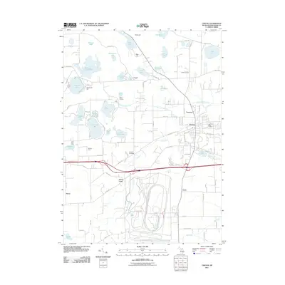
2011 Map of Chelsea
USGS Topo · Published 2011About this map
Chelsea serves as the primary hub of this eastern Michigan landscape, surrounded by a dense network of glacial lakes and rolling high points. The terrain is defined by features like Sugarloaf Hill and Stofer Hill, which overlook a complex hydrology including the Winnewana Impoundment and Cavanaugh Lake. This 2011 survey captures the area's rural character and long-standing community markers, such as Vermont Cemetery and Mount Olivet Cemetery. Smaller clusters like Sylvan Center and Guthrie are connected by local routes like Old Us HWY 12, which runs parallel to the modern interstate corridor. The map is particularly useful for identifying established recreation sites such as Camp Ma-Hi-Ya and Light House Camp, as well as the numerous family-named landmarks and water bodies like Walsh Lake and McLaughlin Lake that illustrate the regional topography of Washtenaw County.
Find a feature on this map
74 named features on this map. Tap any name to fly to it.
Don’t see what you’re looking for? This feature index may not catch every label — zoom into the map to look around manually.
Map Details
Editions of this 2011 Chelsea Map
This is the sole edition of this map. No revisions or reprints were ever made.
Other maps of this area

1902 · Dexter
USGS Topo · 1:62,500

1904 · Ann Arbor
USGS Topo · 1:125,000

1906 · Dexter
USGS Topo · 1:62,500

1906 · Saline
USGS Topo · 1:62,500

1908 · Ann Arbor
USGS Topo · 1:125,000

1919 · Stockbridge
USGS Topo · 1:62,500

1922 · Stockbridge
USGS Topo · 1:62,500

1942 · Stockbridge
USGS Topo · 1:62,500

1948 · Manchester
USGS Topo · 1:62,500

1949 · Manchester
USGS Topo · 1:62,500