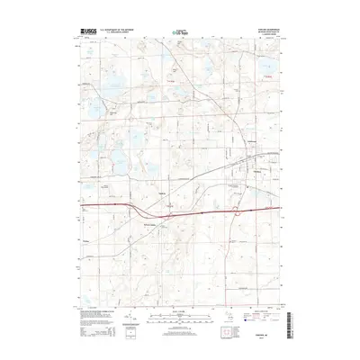
2014 Map of Chelsea
USGS Topo · Published 2014About this map
The village of Chelsea anchors this detailed survey, showing a landscape defined by glacial lakes and a developing transportation corridor. The township is dotted with significant local landmarks including the Chelsea Station and the Chelsea Community Fairgrounds, while small clusters of settlement persist at Sylvan Center, Lanewood, and Guthrie. The northern portion of the quadrangle is notably dense with water bodies such as Winnewana Impoundment, Cavanaugh Lake, and Sugarloaf Lake, reflecting the region's complex post-glacial hydrology. Genealogists and local historians will find a wealth of burial sites recorded, including Pierce Cem, Mt Olivet Cem, and the more remote Vermont Cem to the south. The area’s aviation history is represented by Winters Field Airport, situated near Lehman Lake, while the rural character of the outlying township is maintained by a network of gravel and paved roads connecting various family-named hills like Riley Hill and Stofer Hill.
Find a feature on this map
86 named features on this map. Tap any name to fly to it.
Don’t see what you’re looking for? This feature index may not catch every label — zoom into the map to look around manually.
Map Details
Editions of this 2014 Chelsea Map
This is the sole edition of this map. No revisions or reprints were ever made.
Other maps of this area

1902 · Dexter
USGS Topo · 1:62,500

1904 · Ann Arbor
USGS Topo · 1:125,000

1906 · Dexter
USGS Topo · 1:62,500

1906 · Saline
USGS Topo · 1:62,500

1908 · Ann Arbor
USGS Topo · 1:125,000

1919 · Stockbridge
USGS Topo · 1:62,500

1922 · Stockbridge
USGS Topo · 1:62,500

1942 · Stockbridge
USGS Topo · 1:62,500

1948 · Manchester
USGS Topo · 1:62,500

1949 · Manchester
USGS Topo · 1:62,500