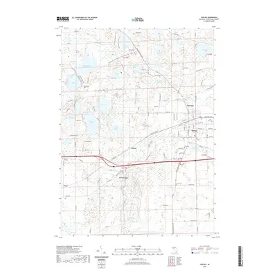
2019 Map of Chelsea
USGS Topo · Published 2019About this map
The village of Chelsea anchors this survey of western Washtenaw County, showcasing a landscape defined by glacial topography and an extensive network of inland waters. The area's commitment to recreation and conservation is evident through the Waterloo Rec Area - Waterloo-Pinckney Hiking Trail and the complex of reservoirs like Winnewana Impoundment. Significant elevation changes are marked by Sugarloaf Hill and Riley Hill, while the lowlands are saturated with named bodies of water including Cavanaugh Lake and Mill Lake. Local history and genealogy are well-represented by numerous burial grounds such as Vermont Cem and Maple Grove Cem near Sylvan Center. Small settlements like Guthrie and Lanewood appear along the road network, while Winters Field provides a distinct aviation landmark in this largely rural and residential terrain.
Find a feature on this map
130 named features on this map. Tap any name to fly to it.
Don’t see what you’re looking for? This feature index may not catch every label — zoom into the map to look around manually.
Map Details
Editions of this 2019 Chelsea Map
This is the sole edition of this map. No revisions or reprints were ever made.
Other maps of this area

1902 · Dexter
USGS Topo · 1:62,500

1904 · Ann Arbor
USGS Topo · 1:125,000

1906 · Dexter
USGS Topo · 1:62,500

1906 · Saline
USGS Topo · 1:62,500

1908 · Ann Arbor
USGS Topo · 1:125,000

1919 · Stockbridge
USGS Topo · 1:62,500

1922 · Stockbridge
USGS Topo · 1:62,500

1942 · Stockbridge
USGS Topo · 1:62,500

1948 · Manchester
USGS Topo · 1:62,500

1949 · Manchester
USGS Topo · 1:62,500