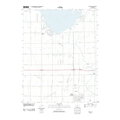
2009 Map of Cheney
USGS Topo · Published 2009About this map
Cheney Reservoir and the North Fork Ninnescah River dominate the northern landscape of this region, which was surveyed during a period of established energy extraction and recreational development. The infrastructure of the Cheney Dam regulates the water levels, while the surrounding land is divided between the agricultural grid and active industrial sites like the Bartholomew Oil Field and Casley Gas and Oil Field.
Find a feature on this map
50 named features on this map. Tap any name to fly to it.
Don’t see what you’re looking for? This feature index may not catch every label — zoom into the map to look around manually.
Map Details
Editions of this 2009 Cheney Map
This is the sole edition of this map. No revisions or reprints were ever made.
Other maps of this area

1889 · Cheney
USGS Topo · 1:125,000

1891 · Cheney
USGS Topo · 1:125,000

1901 · Cheney
USGS Topo · 1:125,000

1955 · Wichita
USGS Topo · 1:250,000

1958 · Wichita
USGS Topo · 1:250,000

1959 · Mount Hope
USGS Topo · 1:24,000

1964 · Cheney
USGS Topo · 1:24,000

1965 · Garden Plain
USGS Topo · 1:24,000

1965 · Cheney SE
USGS Topo · 1:24,000
1965 · Waterloo
USGS Topo · 1:24,000