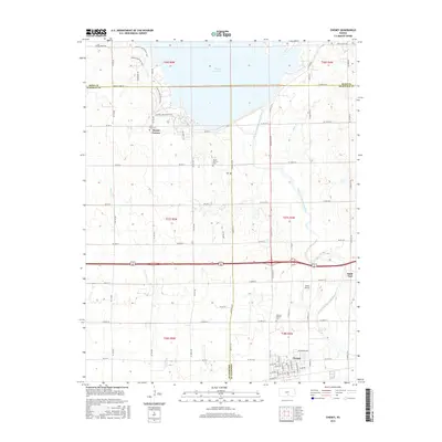
2015 Map of Cheney
USGS Topo · Published 2015About this map
Cheney Reservoir dominates the northern landscape of this region, where the borders of Reno, Kingman, and Sedgwick counties converge. The reservoir, formed by the impoundment of the North Fork Ninnescah River, has fundamentally reshaped the local geography, creating a recreation-focused shoreline marked by the Cheney Lake Main Trail and Lakeshore Dr. South of the water, the terrain transitions into a structured agricultural grid punctuated by small settlements and historic landmarks. The community of Mount Vernon is situated near the reservoir's edge, supported by the nearby Mount Vernon Cem and Saint Rose Cem. Further south, the town of Cheney serves as a local hub, featuring a dense residential street plan and the Cheney Pioneer Cem. This area maintains its rural character through features like Albers Airport and numerous seasonal waterways including Smoots Creek and Nester Cr.
Find a feature on this map
79 named features on this map. Tap any name to fly to it.
Don’t see what you’re looking for? This feature index may not catch every label — zoom into the map to look around manually.
Map Details
Editions of this 2015 Cheney Map
This is the sole edition of this map. No revisions or reprints were ever made.
Other maps of this area

1889 · Cheney
USGS Topo · 1:125,000

1891 · Cheney
USGS Topo · 1:125,000

1901 · Cheney
USGS Topo · 1:125,000

1955 · Wichita
USGS Topo · 1:250,000

1958 · Wichita
USGS Topo · 1:250,000

1959 · Mount Hope
USGS Topo · 1:24,000

1964 · Cheney
USGS Topo · 1:24,000

1965 · Garden Plain
USGS Topo · 1:24,000

1965 · Cheney SE
USGS Topo · 1:24,000
1965 · Waterloo
USGS Topo · 1:24,000