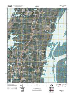
2011 Map of Cheriton
USGS Topo · Published 2011About this map
The Eastern Shore of Virginia in Northampton County unfolds here between the Chesapeake Bay and the Atlantic coastal marshes. This landscape is defined by the traditional peninsular geography of Virginia’s bayside and seaside, with larger inland settlements like Cheriton and Eastville situated along the central spine near Highway 13. To the east, the village of Oyster sits at the edge of the Oyster Slip, representing the region's historic connection to the seafood and maritime industries within Brockenberry Bay.
Find a feature on this map
57 named features on this map. Tap any name to fly to it.
Don’t see what you’re looking for? This feature index may not catch every label — zoom into the map to look around manually.
Map Details
Editions of this 2011 Cheriton Map
This is the sole edition of this map. No revisions or reprints were ever made.
Other maps of this area

1942 · Cheriton
USGS Topo · 1:24,000

1942 · Cobb Island
USGS Topo · 1:24,000

1942 · Nassawadox
USGS Topo · 1:24,000

1943 · Nassawadox
USGS Topo · 1:31,680

1943 · Elliots Creek
USGS Topo · 1:25,000

1943 · Townsend
USGS Topo · 1:24,000

1943 · Franktown
USGS Topo · 1:31,680

1943 · Richmond
USGS Topo · 1:250,000

1946 · Eastville
USGS Topo · 1:250,000

1948 · Cape Charles
USGS Topo · 1:24,000