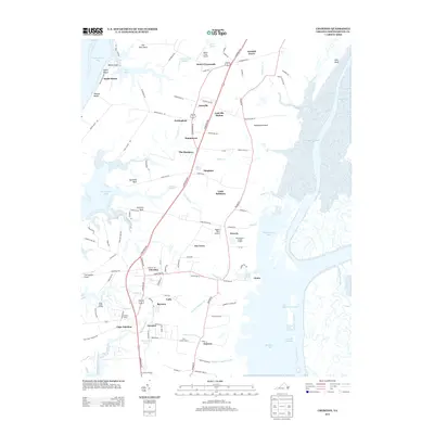
2013 Map of Cheriton
USGS Topo · Published 2013About this map
The Eastern Shore of Virginia in this 2013 survey is defined by a landscape of intricate waterways and coastal necks, spanning from Chesapeake Bay on the west to Mockhorn Bay on the east. The central corridor is anchored by Cheriton and Eastville, representing a series of small agricultural and maritime settlements connected by the Lankford Hwy. These communities, including Eastville Station and Cape Junction, reflect the historical reliance on both the road network and the coastal inlets for commerce and transportation.
Find a feature on this map
123 named features on this map. Tap any name to fly to it.
Don’t see what you’re looking for? This feature index may not catch every label — zoom into the map to look around manually.
Map Details
Editions of this 2013 Cheriton Map
This is the sole edition of this map. No revisions or reprints were ever made.
Other maps of this area

1942 · Cheriton
USGS Topo · 1:24,000

1942 · Cobb Island
USGS Topo · 1:24,000

1942 · Nassawadox
USGS Topo · 1:24,000

1943 · Nassawadox
USGS Topo · 1:31,680

1943 · Elliots Creek
USGS Topo · 1:25,000

1943 · Townsend
USGS Topo · 1:24,000

1943 · Franktown
USGS Topo · 1:31,680

1943 · Richmond
USGS Topo · 1:250,000

1946 · Eastville
USGS Topo · 1:250,000

1948 · Cape Charles
USGS Topo · 1:24,000