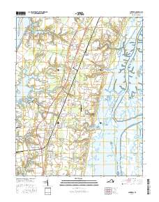
2016 Map of Cheriton
USGS Topo · Published 2016About this map
Cheriton and Eastville anchor this coastal survey of the Virginia Eastern Shore, where the landscape is defined by the peninsula’s narrow profile between the Chesapeake Bay and the Atlantic Ocean. The map reveals a high concentration of small, historic communities such as Stumptown, Pat Town, and Seaview, often situated near the intricate network of tidal creeks and inlets. Notable water features like Cherrystone Inlet and the Oyster Slip at Oyster highlight the region’s long-standing connection to maritime commerce and the shellfish industry. Significant landforms including Eyreville Neck and Savage Neck extend into the bay, while the eastern marshes are home to Mockhorn Island. Local history is preserved in the placement of numerous family and community burial grounds, such as Whitehead Cem and Holland Cem, providing valuable touchpoints for genealogical research alongside transportation hubs like Eastville Station and Eagles Nest Airport.
Find a feature on this map
153 named features on this map. Tap any name to fly to it.
Don’t see what you’re looking for? This feature index may not catch every label — zoom into the map to look around manually.
Map Details
Editions of this 2016 Cheriton Map
This is the sole edition of this map. No revisions or reprints were ever made.
Other maps of this area

1942 · Cheriton
USGS Topo · 1:24,000

1942 · Cobb Island
USGS Topo · 1:24,000

1942 · Nassawadox
USGS Topo · 1:24,000

1943 · Nassawadox
USGS Topo · 1:31,680

1943 · Elliots Creek
USGS Topo · 1:25,000

1943 · Townsend
USGS Topo · 1:24,000

1943 · Franktown
USGS Topo · 1:31,680

1943 · Richmond
USGS Topo · 1:250,000

1946 · Eastville
USGS Topo · 1:250,000

1948 · Cape Charles
USGS Topo · 1:24,000