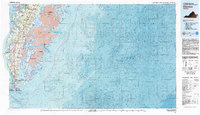
1981 Map of Cheriton
USGS Topo · Published 1981About this map
Cape Charles and the surrounding neck lands of the Virginia Eastern Shore dominate this early 1980s topographic-bathymetric study. The map illustrates the fragile coastal geography of the Delmarva Peninsula, where intensive maritime settlement meets protected wilderness. Inland towns like Cheriton, Eastville, and Capeville are connected by a network of roads and the Charles railroad line, while the seaside is defined by isolated hamlets like Oyster. This era highlights a significant commitment to conservation, with expansive tracts designated as the Wreck Island Natural Area, Mockhorn Island Waterfowl Area, and Fishermans Island National Wildlife Refuge.
Find a feature on this map
81 named features on this map. Tap any name to fly to it.
Don’t see what you’re looking for? This feature index may not catch every label — zoom into the map to look around manually.
Map Details
Editions of this 1981 Cheriton Map
This is the sole edition of this map. No revisions or reprints were ever made.
Other maps of this area

1893 · Virginia Beach
USGS Topo · 1:125,000

1907 · Norfolk
USGS Topo · 1:125,000

1918 · Cape Henry
USGS Topo · 1:62,500

1919 · Cape Henry
USGS Topo · 1:62,500

1931 · Accomac
USGS Topo · 1:48,000

1935 · Accomac
USGS Topo · 1:62,500

1941 · Broadwater
USGS Topo · 1:62,500

1942 · Cheriton
USGS Topo · 1:24,000

1942 · Cobb Island
USGS Topo · 1:24,000

1942 · Great Machipongo Inlet
USGS Topo · 1:24,000