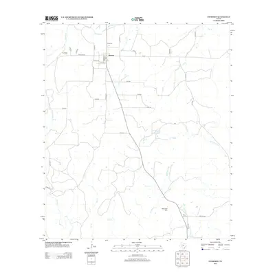
2012 Map of Cherokee
USGS Topo · Published 2012About this map
Cherokee serves as the primary settlement hub for this portion of the Texas Hill Country, situated where Ranch Road 501 and state routes meet. The landscape is defined by its complex hydrology, with numerous seasonal and perennial waterways like Pecan Cr, Wolf Cr, and Wrights Cr draining toward the Little Llano River. For those researching local family histories, the presence of several distinct burial grounds, including the Hanna Cem and Kuykendall Cem, provides vital geographical context for early residents. Near the southern edge of the map, the elevation rises toward Babyhead Mtn, overlooking the Baby Head Cem and the surrounding valley. The road network, including names like Valley Spring Rd and Apache Loop, indicates a rural community structure tied to both ranching and natural topography.
Find a feature on this map
43 named features on this map. Tap any name to fly to it.
Don’t see what you’re looking for? This feature index may not catch every label — zoom into the map to look around manually.
Map Details
Editions of this 2012 Cherokee Map
This is the sole edition of this map. No revisions or reprints were ever made.
Other maps of this area

1885 · San Saba
USGS Topo · 1:125,000

1887 · Llano
USGS Topo · 1:125,000

1894 · San Saba
USGS Topo · 1:125,000

1894 · Llano
USGS Topo · 1:125,000

1904 · Llano
USGS Topo · 1:125,000

1909 · Llano
USGS Topo · 1:125,000

1918 · Llano
USGS Topo · 1:125,000

1931 · Bend
USGS Topo · 1:62,500

1954 · Brownwood
USGS Topo · 1:250,000

1954 · Llano
USGS Topo · 1:250,000