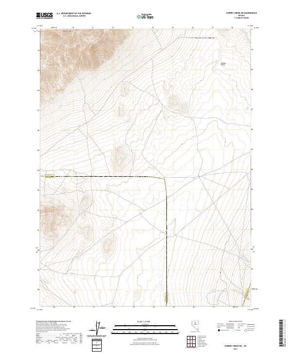
2021 Map of Cherry Creek NE
USGS Topo · Published 2021About this map
Buffalo Mtn dominates the northern landscape of this Humboldt County region, where high desert elevations meet the broad expanse of Buffalo Valley. The terrain is defined by its administrative and historical boundaries, marking the convergence of Humboldt, Pershing, and Lander counties. This 2021 survey shows a landscape largely shaped by seasonal hydrology, where drainages like Trenton Cr and Mill Creek cut through the arid basins. The surveyor's grid reveals the vast scale of the Great Basin, with section lines and township markers such as t33n r41e and t32n r42e providing the primary structure for land navigation in this sparsely populated interior.
Find a feature on this map
12 named features on this map. Tap any name to fly to it.
Don’t see what you’re looking for? This feature index may not catch every label — zoom into the map to look around manually.
Map Details
Editions of this 2021 Cherry Creek NE Map
This is the sole edition of this map. No revisions or reprints were ever made.
Other maps of this area

1932 · Sonoma Range
USGS Topo · 1:250,000

1939 · Sonoma Range
USGS Topo · 1:250,000

1940 · Antler Peak
USGS Topo · 1:62,500

1943 · Antler Peak
USGS Topo · 1:62,500

1955 · Winnemucca
USGS Topo · 1:250,000

1958 · Winnemucca
USGS Topo · 1:250,000

1962 · Winnemucca
USGS Topo · 1:250,000

1965 · Goldrun Creek
USGS Topo · 1:24,000

1965 · Edna Mountain
USGS Topo · 1:62,500
1965 · Brooks Spring
USGS Topo · 1:24,000