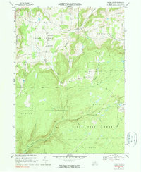
1970 Map of Cherry Flats
USGS Topo · Published 1990About this map
The Welsh Settlement Ch and its accompanying Welsh Settlement Cem stand as significant markers of the ethnic history within the Charleston and Covington township boundaries. This 1970 snapshot of Tioga County shows a landscape defined by the intersection of forest conservation and industrial extraction, where the Tioga State Forest covers large tracts of terrain once altered by coal operations. Evidence of the area's mining history is scattered throughout the hills, most notably through the presence of Strip Mines and a Mine Dump near the old settlement of Landrus.
Find a feature on this map
33 named features on this map. Tap any name to fly to it.
Don’t see what you’re looking for? This feature index may not catch every label — zoom into the map to look around manually.
Map Details
Editions of this 1970 Cherry Flats Map
3 editions found
Other maps of this area

1900 · Tioga
USGS Topo · 1:62,500

1900 · Elkland
USGS Topo · 1:62,500

1902 · Tioga
USGS Topo · 1:62,500

1925 · Blossburg
USGS Topo · 1:62,500

1927 · Blossburg
USGS Topo · 1:62,500

1944 · Blossburg
USGS Topo · 1:62,500

1946 · Antrim
USGS Topo · 1:62,500

1946 · Antrim
USGS Topo · 1:24,000

1946 · Morris
USGS Topo · 1:24,000

1948 · Antrim
USGS Topo · 1:24,000
Featured Places
- Morris Township, PA
- Duncan Township, PA
- Bloss Township, PA
- Cherry Flats, Covington Township
- Liberty Township, PA