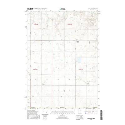
2016 Map of Cherry Grove
USGS Topo · Published 2016About this map
Etna, Cherry Grove, and York anchor this portion of southern Fillmore County, where the landscape is defined by the winding waters of the S Br Root River and Canfield Cr. The map illustrates a rural area deeply connected to its local heritage, evidenced by a high density of community burial sites including Etna Cem, Cherry Grove Cem, Bethlehem Cem, Canfield Cem, and Love Cem. These locations offer significant value for genealogical research, marking the historic centers of local family life and settlement. The rectilinear grid of county roads, such as Co HWY 14 and Co RD 44, transitions into State Line RD at the southern margin, marking the jurisdictional boundary between Minnesota and Iowa. This 2016 survey captures a traditional agricultural region where the placement of cemeteries and small settlements preserves the footprint of early regional development along the river's southern branch.
Find a feature on this map
29 named features on this map. Tap any name to fly to it.
Don’t see what you’re looking for? This feature index may not catch every label — zoom into the map to look around manually.
Map Details
Editions of this 2016 Cherry Grove Map
This is the sole edition of this map. No revisions or reprints were ever made.
Other maps of this area

1954 · Mason City
USGS Topo · 1:250,000

1957 · Mason City
USGS Topo · 1:250,000

1958 · Mason City
USGS Topo · 1:250,000

1965 · Greenleafton
USGS Topo · 1:24,000

1965 · Wykoff
USGS Topo · 1:24,000

1965 · Spring Valley
USGS Topo · 1:24,000

1965 · Ostrander
USGS Topo · 1:24,000

1965 · Fountain
USGS Topo · 1:24,000

1965 · Cherry Grove
USGS Topo · 1:24,000

1981 · Cresco NW
USGS Topo · 1:24,000