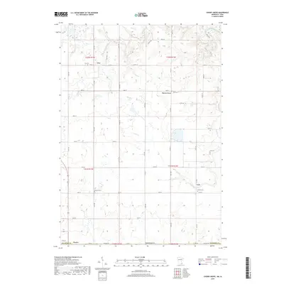
2019 Map of Cherry Grove
USGS Topo · Published 2019About this map
Etna and Cherry Grove sit within a landscape shaped by the branching drainage of the S Br Root River. This section of Fillmore County is defined by its agricultural grid, where townships like t102n r13w and t101n r12w are partitioned by a network of gravel and paved routes including Co HWY 14 and 171st Ave. The map reveals a high density of small rural burial grounds, such as Bethlehem Cem and Love Cem, which often serve as the primary markers for historical communities that have otherwise consolidated. Along the southern edge, the State Line Rd marks the border near Chester, while Canfield Cr winds through the southeastern hills toward the settlement of York.
Find a feature on this map
46 named features on this map. Tap any name to fly to it.
Don’t see what you’re looking for? This feature index may not catch every label — zoom into the map to look around manually.
Map Details
Editions of this 2019 Cherry Grove Map
This is the sole edition of this map. No revisions or reprints were ever made.
Other maps of this area

1954 · Mason City
USGS Topo · 1:250,000

1957 · Mason City
USGS Topo · 1:250,000

1958 · Mason City
USGS Topo · 1:250,000

1965 · Greenleafton
USGS Topo · 1:24,000

1965 · Wykoff
USGS Topo · 1:24,000

1965 · Spring Valley
USGS Topo · 1:24,000

1965 · Ostrander
USGS Topo · 1:24,000

1965 · Fountain
USGS Topo · 1:24,000

1965 · Cherry Grove
USGS Topo · 1:24,000

1981 · Cresco NW
USGS Topo · 1:24,000