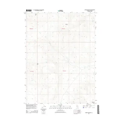
2015 Map of Cherry Mountain
USGS Topo · Published 2015About this map
Cherry Mountain and Rush Creek Mtn dominate this high-desert landscape in northeastern California, where the seasonal drainage patterns of the Smoke Creek Mountains define the local geography. This high-altitude terrain is marked by a network of water sources vital to the region's ranching and ecological history, including Hostetter and Johnson Spring, Cherry Spring, and the clustered Three Springs. The map details the headwaters of Rush Cr and its various tributaries, such as S Fork Rush Cr and Stony Cr, which carve through the volcanic uplands. This area, spanning the border of Lassen and Modoc counties, remains largely undeveloped, preserving the original public land survey system grid lines through townships t32n r17e and t31n r17e. The presence of Five Springs Mtn and Rush Creek Spring provides specific landmarks for those tracing historical land use or geological features in this remote corner of the state.
Find a feature on this map
15 named features on this map. Tap any name to fly to it.
Don’t see what you’re looking for? This feature index may not catch every label — zoom into the map to look around manually.
Map Details
Editions of this 2015 Cherry Mountain Map
This is the sole edition of this map. No revisions or reprints were ever made.
Other maps of this area

1886 · Honey Lake
USGS Topo · 1:250,000

1886 · Granite Range
USGS Topo · 1:250,000

1891 · Honey Lake
USGS Topo · 1:250,000

1893 · Honey Lake
USGS Topo · 1:250,000

1894 · Granite Range
USGS Topo · 1:250,000

1954 · Wendel
USGS Topo · 1:62,500

1954 · Shinn Mountain
USGS Topo · 1:62,500

1955 · Westwood
USGS Topo · 1:250,000

1955 · Lovelock
USGS Topo · 1:250,000

1958 · Westwood
USGS Topo · 1:250,000