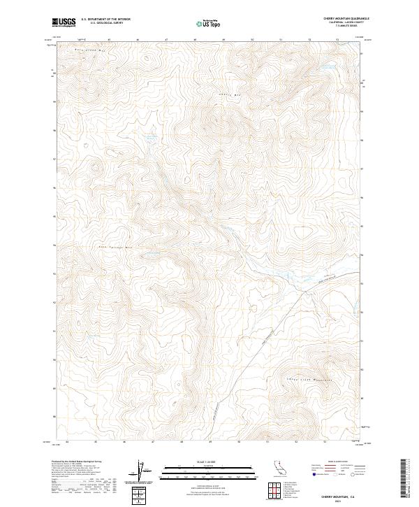
2021 Map of Cherry Mountain
USGS Topo · Published 2021About this map
Smoke Creek Mountains dominate this high-desert portion of Lassen County, where water is the primary geographic driver of naming and movement. This 2021 survey of the Cherry Mountain area highlights a series of vital water sources, including the family-named Hostetter and Johnson Spring and the centralized Rush Creek Spring. These springs feed a network of drainages such as Rush Creek and the South Fork Rush Creek, which carve their way between prominent peaks like Rush Creek Mountain and Five Springs Mountain. The solitary Smokey Creek Ranch Rd provides the only significant vehicular access through the township lines of T31N and T32N, tracing a path that follows the natural contours of the terrain toward Three Springs. This map effectively documents the reliance on named springs and creek forks for navigating and utilizing the high-altitude volcanic landscape.
Find a feature on this map
15 named features on this map. Tap any name to fly to it.
Don’t see what you’re looking for? This feature index may not catch every label — zoom into the map to look around manually.
Map Details
Editions of this 2021 Cherry Mountain Map
This is the sole edition of this map. No revisions or reprints were ever made.
Other maps of this area

1886 · Honey Lake
USGS Topo · 1:250,000

1886 · Granite Range
USGS Topo · 1:250,000

1891 · Honey Lake
USGS Topo · 1:250,000

1893 · Honey Lake
USGS Topo · 1:250,000

1894 · Granite Range
USGS Topo · 1:250,000

1954 · Wendel
USGS Topo · 1:62,500

1954 · Shinn Mountain
USGS Topo · 1:62,500

1955 · Westwood
USGS Topo · 1:250,000

1955 · Lovelock
USGS Topo · 1:250,000

1958 · Westwood
USGS Topo · 1:250,000