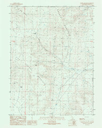
1989 Map of Cherry Mountain
USGS Topo · Published 1989About this map
Cherry Mountain and its surrounding peaks define this high-altitude landscape in Lassen County during the late 1980s. The terrain is characterized by a network of drainage systems and high ridges, most notably Rush Creek Mountain and Five Springs Mountain. The hydrology of the area is dominated by Rush Creek and numerous vital water sources that sustained local livestock and wildlife, including Cherry Spring, Rush Creek Spring, and the aptly named Three Springs. This 1989 provisional map, based on aerial photography from 1984, shows a rugged area primarily defined by natural landmarks rather than human settlements, illustrating the remote character of the California backcountry at the time. The grid system of T 32 N and T 31 N provides a framework for understanding the land divisions in this part of the Sierra Nevada foothills.
Find a feature on this map
9 named features on this map. Tap any name to fly to it.
Don’t see what you’re looking for? This feature index may not catch every label — zoom into the map to look around manually.
Map Details
Editions of this 1989 Cherry Mountain Map
This is the sole edition of this map. No revisions or reprints were ever made.
Other maps of this area

1886 · Honey Lake
USGS Topo · 1:250,000

1886 · Granite Range
USGS Topo · 1:250,000

1891 · Honey Lake
USGS Topo · 1:250,000

1893 · Honey Lake
USGS Topo · 1:250,000

1894 · Granite Range
USGS Topo · 1:250,000

1954 · Wendel
USGS Topo · 1:62,500

1954 · Shinn Mountain
USGS Topo · 1:62,500

1955 · Westwood
USGS Topo · 1:250,000

1955 · Lovelock
USGS Topo · 1:250,000

1958 · Westwood
USGS Topo · 1:250,000