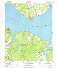
1951 Map of Cherry Point
USGS Topo · Published 1973About this map
The US Marine Corps Air Station Cherry Point dominates the southern bank of the Neuse River in this mid-century topographic survey, showing the military installation alongside the vast reaches of the Croatan National Forest. On the northern shore, the community of Minnesott Beach and the seasonal youth camps of Camp Seagull and Camp Don-Lee define the recreational character of the riverfront. The map reveals a landscape deeply carved by numerous tidal inlets and creeks, such as Hancock Creek and Clubfoot Creek, which served as vital waterways for timber and transport long before the airfield's establishment. Local history is preserved through scattered rural landmarks like the Gatlin Creek Sch, Piney Grove Ch, and the Weeping Mary Ch, reflecting the dispersed settlement patterns of eastern North Carolina during the post-war period.
Find a feature on this map
58 named features on this map. Tap any name to fly to it.
Don’t see what you’re looking for? This feature index may not catch every label — zoom into the map to look around manually.
Map Details
Editions of this 1951 Cherry Point Map
2 editions found
Other maps of this area

1948 · Oriental
USGS Topo · 1:24,000

1949 · Havelock
USGS Topo · 1:24,000

1949 · Merrimon
USGS Topo · 1:24,000

1949 · Newport
USGS Topo · 1:24,000

1949 · Cherry Point
USGS Topo · 1:24,000

1949 · Core Creek
USGS Topo · 1:24,000

1949 · Masontown
USGS Topo · 1:24,000

1950 · Upper Broad Creek
USGS Topo · 1:24,000

1950 · Arapahoe
USGS Topo · 1:24,000

1951 · Newport
USGS Topo · 1:24,000