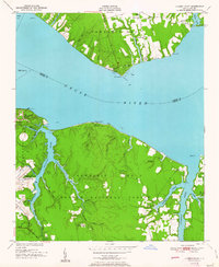
1951 Map of Cherry Point
USGS Topo · Published 1951About this map
The US Marine Corps Air Station Cherry Point dominates the western shoreline of this 1951 survey, appearing alongside the U S Naval Reservation as military operations established a firm presence in eastern North Carolina. Across the wide Neuse River, the northern shore reveals a different character, marked by leisure and community at Minnesott Beach and youth retreats like Camp Don-Lee and Camp Seagull. The landscape is deeply etched by a network of tidal creeks and guts, including Hancock Creek and Cahoogue Creek, which penetrate the dense timber of the Croatan National Forest. These waterways served as the primary conduits for local life before modern road networks were fully realized, connecting small settlements like Blades and Bachelor to the river commerce. Cultural landmarks such as Weeping Mary Ch and Small Chapel provide essential points of reference for genealogists tracing family roots in this coastal region.
Find a feature on this map
46 named features on this map. Tap any name to fly to it.
Don’t see what you’re looking for? This feature index may not catch every label — zoom into the map to look around manually.
Map Details
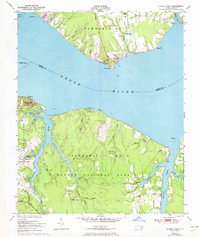
Editions of this 1951 Cherry Point Map
2 editions found
Other maps of this area

1948 · Oriental
USGS Topo · 1:24,000

1949 · Havelock
USGS Topo · 1:24,000

1949 · Merrimon
USGS Topo · 1:24,000

1949 · Newport
USGS Topo · 1:24,000

1949 · Cherry Point
USGS Topo · 1:24,000

1949 · Core Creek
USGS Topo · 1:24,000

1949 · Masontown
USGS Topo · 1:24,000

1950 · Upper Broad Creek
USGS Topo · 1:24,000

1950 · Arapahoe
USGS Topo · 1:24,000

1951 · Newport
USGS Topo · 1:24,000