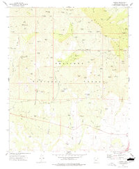
1973 Map of Cherry
USGS Topo · Published 1977About this map
Mining operations and water sources define the eastern slopes of the Black Hills within the Prescott National Forest. The small settlement of Cherry serves as a central hub, surrounded by a high density of lode claims and workings. Notable operations include the Cherry King Mine, Sitting Bull Mine, and the Golden Idol Mine, connected by a network of steep jeep and pack trails. This pattern of land use reflects the rugged prospecting history of Yavapai County, where individual claims were often established near vital water points like Cherry Creek and Willow Spring.
Find a feature on this map
92 named features on this map. Tap any name to fly to it.
Don’t see what you’re looking for? This feature index may not catch every label — zoom into the map to look around manually.
Map Details
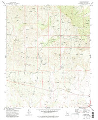
Editions of this 1973 Cherry Map
2 editions found
Other maps of this area

1887 · Verde
USGS Topo · 1:250,000

1887 · Prescott
USGS Topo · 1:250,000

1892 · Verde
USGS Topo · 1:250,000

1892 · Prescott
USGS Topo · 1:250,000

1903 · Bradshaw Mountains
USGS Topo · 1:125,000

1905 · Jerome
USGS Topo · 1:125,000

1923 · Camp Verde
USGS Topo · 1:125,000

1929 · Turret Peak
USGS Topo · 1:125,000

1932 · Camp Verde
USGS Topo · 1:125,000

1933 · Turret Peak
USGS Topo · 1:125,000