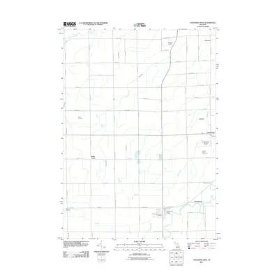
2011 Map of Chesaning West
USGS Topo · Published 2011About this map
The Shiawassee River cuts across the southeast corner of this Saginaw County landscape, connecting the small riverside communities of Oakley and Parshallburg. This area reflects a deep-rooted agricultural and civic layout, where the rectangular grid of rural roads like S Hemlock Rd and Fordney Rd is punctuated by historic churchyards and cemeteries, including Saint Michael's Catholic Cemetery and the remote Ridge Road Cemetery. These sites provide significant data for genealogical research in Chesaning Township.
Find a feature on this map
57 named features on this map. Tap any name to fly to it.
Don’t see what you’re looking for? This feature index may not catch every label — zoom into the map to look around manually.
Map Details
Editions of this 2011 Chesaning West Map
This is the sole edition of this map. No revisions or reprints were ever made.
Other maps of this area

1917 · Chesaning
USGS Topo · 1:62,500

1917 · St. Charles
USGS Topo · 1:62,500

1918 · Elsie
USGS Topo · 1:62,500

1934 · Merrill
USGS Topo · 1:62,500

1937 · Merrill
USGS Topo · 1:62,500

1943 · Chesaning
USGS Topo · 1:62,500

1943 · St. Charles
USGS Topo · 1:62,500

1943 · Elsie
USGS Topo · 1:62,500

1954 · Midland
USGS Topo · 1:250,000

1958 · Midland
USGS Topo · 1:250,000