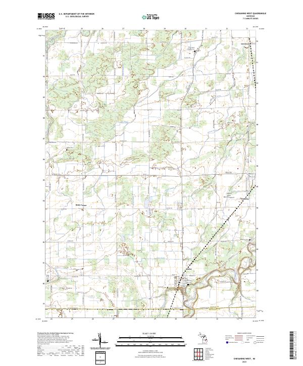
2023 Map of Chesaning West
USGS Topo · Published 2023About this map
Chesaning and the surrounding agricultural landscape of Saginaw County are defined by an intricate network of waterways and rural section roads. The Shiawassee River winds through the southeastern portion of the map, passing the village of Oakley where several local cemeteries, such as Saint Michael's Catholic Cem and Oak Grove Cem, serve as important markers for genealogical research. The terrain is crisscrossed by numerous drainage systems including Blackmer Drain and Carson Drain, reflecting the engineered landscape necessary for farming in this region.
Find a feature on this map
71 named features on this map. Tap any name to fly to it.
Don’t see what you’re looking for? This feature index may not catch every label — zoom into the map to look around manually.
Map Details
Editions of this 2023 Chesaning West Map
This is the sole edition of this map. No revisions or reprints were ever made.
Other maps of this area

1917 · Chesaning
USGS Topo · 1:62,500

1917 · St. Charles
USGS Topo · 1:62,500

1918 · Elsie
USGS Topo · 1:62,500

1934 · Merrill
USGS Topo · 1:62,500

1937 · Merrill
USGS Topo · 1:62,500

1943 · Chesaning
USGS Topo · 1:62,500

1943 · St. Charles
USGS Topo · 1:62,500

1943 · Elsie
USGS Topo · 1:62,500

1954 · Midland
USGS Topo · 1:250,000

1958 · Midland
USGS Topo · 1:250,000