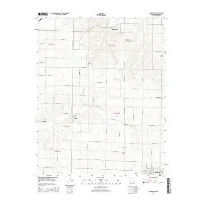
2015 Map of Chesapeake
USGS Topo · Published 2015About this map
Chesapeake sits at the northern edge of this southwestern Missouri landscape, where the headwaters of Chesapeake Br flow through a region defined by agricultural plots and family-centered landmarks. The southern portion of the map transition into the outskirts of Marionville, showing the residential street grid at its northern boundary. Throughout the territory, the presence of several small burial grounds including Grammer Cemetery, Campground Cemetery, and Woodland Cemetery suggests a deeply rooted rural community structure. This 2015 survey illustrates a persistent pattern of rural life, where small settlements like Orange, McKinley, and Elliott serve as focal points along an extensive network of farm roads. The drainage of the area is carved by watercourses such as Honey Cr and Williams Cr, which wind through the township boundaries of T27N and T28N, while Polk Spring provides a distinct natural point of interest in the southern hills.
Find a feature on this map
85 named features on this map. Tap any name to fly to it.
Don’t see what you’re looking for? This feature index may not catch every label — zoom into the map to look around manually.
Map Details
Editions of this 2015 Chesapeake Map
This is the sole edition of this map. No revisions or reprints were ever made.
Other maps of this area

1886 · Greenfield
USGS Topo · 1:125,000

1888 · Greenfield
USGS Topo · 1:125,000

1919 · Halltown
USGS Topo · 1:62,500

1921 · Stotts City
USGS Topo · 1:62,500

1942 · Aurora
USGS Topo · 1:62,500

1943 · Monett
USGS Topo · 1:62,500

1945 · Harrison
USGS Topo · 1:250,000

1945 · Aurora
USGS Topo · 1:62,500

1949 · Harrison
USGS Topo · 1:250,000

1954 · Harrison
USGS Topo · 1:250,000