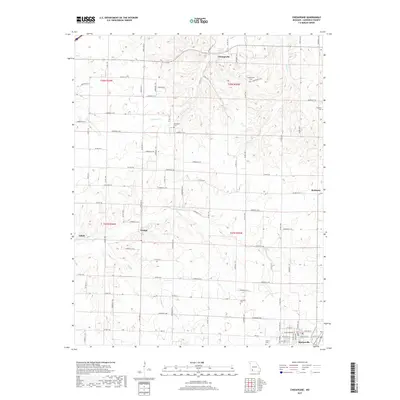
2017 Map of Chesapeake
USGS Topo · Published 2017About this map
Chesapeake and Orange anchor this Lawrence County landscape, defined by a network of rural roads and spring-fed waterways. The terrain is deeply inscribed by the Ozark Plateau drainage patterns of Williams Cr and Honey Cr, which flow through a countryside still organized around historic land divisions. Small family and community cemeteries, such as Woodland Cem, Campground Cem, and Grammer Cem, are scattered across the township, marking the long-term settlement of the region. The map captures the interface between these agricultural crossroads and the northern edge of Marionville, where the grid of city streets meets the larger rural tracts. The presence of Polk Spring and numerous unnamed ponds suggests the importance of karst topography and water access to the local farmsteads and small communities like McKinley and Elliott.
Find a feature on this map
84 named features on this map. Tap any name to fly to it.
Don’t see what you’re looking for? This feature index may not catch every label — zoom into the map to look around manually.
Map Details
Editions of this 2017 Chesapeake Map
This is the sole edition of this map. No revisions or reprints were ever made.
Other maps of this area

1886 · Greenfield
USGS Topo · 1:125,000

1888 · Greenfield
USGS Topo · 1:125,000

1919 · Halltown
USGS Topo · 1:62,500

1921 · Stotts City
USGS Topo · 1:62,500

1942 · Aurora
USGS Topo · 1:62,500

1943 · Monett
USGS Topo · 1:62,500

1945 · Harrison
USGS Topo · 1:250,000

1945 · Aurora
USGS Topo · 1:62,500

1949 · Harrison
USGS Topo · 1:250,000

1954 · Harrison
USGS Topo · 1:250,000