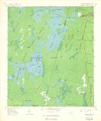
1965 Map of Chesser Island
USGS Topo · Published 1966About this map
Okefenokee National Wildlife Refuge dominates this mid-1960s experimental photomosaic, revealing the complex aquatic geography of the Georgia swamp. The landscape is a mosaic of open water and floating vegetation, characterized by extensive prairies like Buck Prairie and Mizelle Prairie. The presence of the Suwanee Canal in the northeast corner near Camp Cornelia highlights historical attempts to alter the swamp's hydrology, while the surrounding Chesser Prairie remains a network of cypress heads and islands.
Find a feature on this map
43 named features on this map. Tap any name to fly to it.
Don’t see what you’re looking for? This feature index may not catch every label — zoom into the map to look around manually.
Map Details
Editions of this 1965 Chesser Island Map
3 editions found
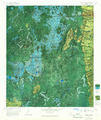
Other maps of this area

1918 · Folkston
USGS Topo · 1:62,500

1918 · Moniac
USGS Topo · 1:62,500

1942 · Moniac
USGS Topo · 1:62,500

1954 · Valdosta
USGS Topo · 1:250,000

1956 · Eddy
USGS Topo · 1:24,000

1958 · Valdosta
USGS Topo · 1:250,000

1959 · Valdosta
USGS Topo · 1:250,000

1965 · Chesser Island
USGS Topo · 1:24,000

1965 · Chase Prairie
USGS Topo · 1:24,000

1965 · Blackjack Island
USGS Topo · 1:24,000