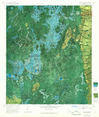
1965 Map of Chesser Island
USGS Topo · Published 1967About this map
Okefenokee National Wildlife Refuge dominates this mid-1960s phototopographic study, revealing the intricate water and land patterns of the southeastern Georgia wetlands. The map provides an overhead perspective of the Suwannee Canal as it cuts through the dense vegetation of Chesser Prairie and Mizell Prairie. Unlike traditional topographic maps, this edition uses a green-and-blue photomosaic base to distinguish between open water like Cooter Lake and the various "prairies," which are actually marshy areas of aquatic plants and grasses.
Find a feature on this map
33 named features on this map. Tap any name to fly to it.
Don’t see what you’re looking for? This feature index may not catch every label — zoom into the map to look around manually.
Map Details
Editions of this 1965 Chesser Island Map
3 editions found
Other maps of this area

1918 · Folkston
USGS Topo · 1:62,500

1918 · Moniac
USGS Topo · 1:62,500

1942 · Moniac
USGS Topo · 1:62,500

1954 · Valdosta
USGS Topo · 1:250,000

1956 · Eddy
USGS Topo · 1:24,000

1958 · Valdosta
USGS Topo · 1:250,000

1959 · Valdosta
USGS Topo · 1:250,000

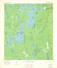
1965 · Chesser Island
USGS Topo · 1:24,000

1965 · Chase Prairie
USGS Topo · 1:24,000

1965 · Blackjack Island
USGS Topo · 1:24,000