
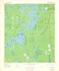
1965 Map of Chesser Island
USGS Topo · Published 1966About this map
Okefenokee Swamp dominates this experimental photomap, revealing the intricate water and land patterns of the Okefenokee National Wildlife Refuge in the mid-1960s. The landscape is a complex mosaic of open water and submerged swamp, where larger landmasses like Chesser Island and Hog Island rise above the surrounding wetlands. This specific survey was developed using 1965 aerial photography, providing a precise look at the drainage and vegetation structures before later environmental changes. Navigation through the marsh is marked by the Suwanee Canal and various named passages such as Goose House Gap. Scattered throughout the watery prairies are small islands and named lakes, including Buzzard Roost Lake and Monkey Lake, while the eastern edge is defined by the raised ground of the Ridge. The map documents the boundary between Ware Co and Charlton Co as it cuts through the heart of Chesser Prairie.
Find a feature on this map
36 named features on this map. Tap any name to fly to it.
Don’t see what you’re looking for? This feature index may not catch every label — zoom into the map to look around manually.
Map Details
Editions of this 1965 Chesser Island Map
3 editions found
Other maps of this area

1918 · Folkston
USGS Topo · 1:62,500

1918 · Moniac
USGS Topo · 1:62,500

1942 · Moniac
USGS Topo · 1:62,500

1954 · Valdosta
USGS Topo · 1:250,000

1956 · Eddy
USGS Topo · 1:24,000

1958 · Valdosta
USGS Topo · 1:250,000

1959 · Valdosta
USGS Topo · 1:250,000

1965 · Chase Prairie
USGS Topo · 1:24,000

1965 · Blackjack Island
USGS Topo · 1:24,000
1966 · Billys Island
USGS Topo · 1:24,000