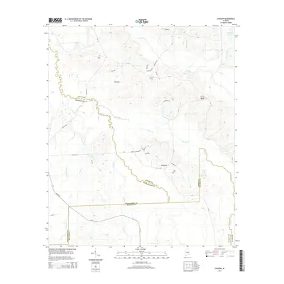
2014 Map of Chesson
USGS Topo · Published 2014About this map
Line Cr and Old Town Cr carve a meandering path through this Alabama landscape, defining the boundaries where Macon, Montgomery, and Bullock counties meet. The settlement of Shorter sits in the northwest, while the small community of Chesson is positioned further south, linked by a network of rural routes including Chesson Plantation Rd. The map is particularly valuable for genealogists, as it meticulously identifies several family and community burial grounds, such as Mt Olive Cem, Mt Zion Cem, and Oswalt Cem.
Find a feature on this map
46 named features on this map. Tap any name to fly to it.
Don’t see what you’re looking for? This feature index may not catch every label — zoom into the map to look around manually.
Map Details
Editions of this 2014 Chesson Map
This is the sole edition of this map. No revisions or reprints were ever made.
Other maps of this area

1953 · Montgomery
USGS Topo · 1:250,000

1955 · Phenix City
USGS Topo · 1:250,000

1956 · Montgomery
USGS Topo · 1:250,000

1957 · Phenix City
USGS Topo · 1:250,000

1957 · Montgomery
USGS Topo · 1:250,000

1958 · Phenix City
USGS Topo · 1:250,000

1958 · Mount Meigs
USGS Topo · 1:62,500

1971 · Shorter
USGS Topo · 1:24,000

1971 · La Place
USGS Topo · 1:24,000

1971 · Hardaway
USGS Topo · 1:24,000