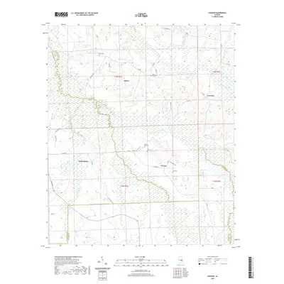
2020 Map of Chesson
USGS Topo · Published 2020About this map
Chesson and Shorter anchor this landscape where the boundaries of Montgomery, Macon, and Bullock Counties converge. The terrain is defined by the winding course of Old Town Cr and its associated wetlands, which dominate the central and southern portions of the quadrangle. Agricultural and residential life is organized around historical property lines and family landmarks, including a cluster of several cemeteries such as White Cem, Mount Zion Cem, and Silah Cem. The map illustrates the contemporary rural character of the region, where legacy roads like Chesson Plantation Rd and Bargainer Rd connect dispersed settlements. Water features including Weiss Lake, Spains Lake, and Cubahatchee Cr reflect the natural drainage patterns of the Alabama coastal plain in the early 21st century.
Find a feature on this map
49 named features on this map. Tap any name to fly to it.
Don’t see what you’re looking for? This feature index may not catch every label — zoom into the map to look around manually.
Map Details
Editions of this 2020 Chesson Map
This is the sole edition of this map. No revisions or reprints were ever made.
Other maps of this area

1953 · Montgomery
USGS Topo · 1:250,000

1955 · Phenix City
USGS Topo · 1:250,000

1956 · Montgomery
USGS Topo · 1:250,000

1957 · Phenix City
USGS Topo · 1:250,000

1957 · Montgomery
USGS Topo · 1:250,000

1958 · Phenix City
USGS Topo · 1:250,000

1958 · Mount Meigs
USGS Topo · 1:62,500

1971 · Shorter
USGS Topo · 1:24,000

1971 · La Place
USGS Topo · 1:24,000

1971 · Hardaway
USGS Topo · 1:24,000