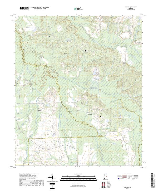
2024 Map of Chesson
USGS Topo · Published 2024About this map
The borders of Macon, Montgomery, and Bullock counties converge in this detailed mapping of the Alabama Black Belt. The community of Shorter and the smaller settlement of Chesson are established along a network of county roads, including Co RD 4 and Chesson Plantation Rd. The landscape is defined by the winding paths of Cubahatchee Creek and Old Town Creek, which flow through low-lying areas punctuated by several private burial grounds. For those tracing family histories, the locations of White Cem, Mount Zion Cem, and Oswalt Cem provide essential geographic context for the area's rural residents. The map also documents the transition from agriculture to modern rural residential use, seen in the newer developments near Pike Road and the scattered homes along Silo Ridge Ln and Foggy Hollow Trl. Small water bodies like Weiss Lake and Spains Lake are also identified among the drainage of Line Creek.
Find a feature on this map
55 named features on this map. Tap any name to fly to it.
Don’t see what you’re looking for? This feature index may not catch every label — zoom into the map to look around manually.
Map Details
Editions of this 2024 Chesson Map
This is the sole edition of this map. No revisions or reprints were ever made.
Other maps of this area

1953 · Montgomery
USGS Topo · 1:250,000

1955 · Phenix City
USGS Topo · 1:250,000

1956 · Montgomery
USGS Topo · 1:250,000

1957 · Phenix City
USGS Topo · 1:250,000

1957 · Montgomery
USGS Topo · 1:250,000

1958 · Phenix City
USGS Topo · 1:250,000

1958 · Mount Meigs
USGS Topo · 1:62,500

1971 · Shorter
USGS Topo · 1:24,000

1971 · La Place
USGS Topo · 1:24,000

1971 · Hardaway
USGS Topo · 1:24,000