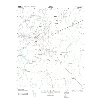
2011 Map of Chester
USGS Topo · Published 2011About this map
Chester serves as the focal point of this 2011 survey, showing a landscape where textile heritage and modern residential growth meet. The map documents the spatial relationship between the town's industrial past, evidenced by Gayle Mill and Eureka Mills, and its surrounding neighborhoods such as Brooklyn, York Terrace, and Hilltop Acres. Beyond the town center, the terrain is defined by a dense network of watercourses including Rocky Creek, Bull Run Creek, and the Little Sandy River, many of which have been managed through an extensive series of dams and reservoirs like the Chester Reservoir and Chester State Park Lake.
Find a feature on this map
126 named features on this map. Tap any name to fly to it.
Don’t see what you’re looking for? This feature index may not catch every label — zoom into the map to look around manually.
Map Details
Editions of this 2011 Chester Map
This is the sole edition of this map. No revisions or reprints were ever made.
Other maps of this area

1907 · Sharon
USGS Topo · 1:62,500

1941 · Spartanburg
USGS Topo · 1:250,000

1949 · Rock Hill
USGS Topo · 1:62,500

1953 · Spartanburg
USGS Topo · 1:250,000

1960 · Spartanburg
USGS Topo · 1:250,000

1963 · Spartanburg
USGS Topo · 1:250,000

1964 · Spartanburg
USGS Topo · 1:250,000

1968 · Blackstock
USGS Topo · 1:24,000
1969 · Stover
USGS Topo · 1:24,000
1969 · Richburg
USGS Topo · 1:24,000