2024 Map of Chester
USGS Topo · Published 2024About this map
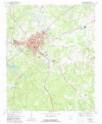
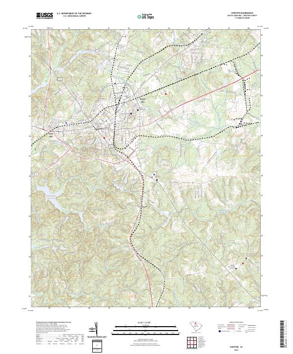
The textile heritage and civic center of Chester anchor this South Carolina landscape, where industrial sites like Eureka Mill and Gayle Mill sit alongside established residential and commercial districts. The local transportation network is defined by a dense grid of streets such as Gadsden St and Pinckney St, while the L & C RR provides a critical rail link through the county seat. The map traces the historical memory of the community through several significant burial grounds, including the Old Purity Cem and Evergreen Cem, which lie near the town center.
Find a feature on this map
142 named features on this map. Tap any name to fly to it.
Don’t see what you’re looking for? This feature index may not catch every label — zoom into the map to look around manually.
Map Details
Editions of this 2024 Chester Map
This is the sole edition of this map. No revisions or reprints were ever made.