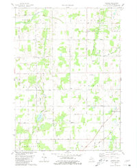
1980 Map of Chester
USGS Topo · Published 1981About this map
The Thornapple River and its various tributaries, including Lacey Creek and the Little Thornapple River, define the rural landscape of central Eaton County. This 1980 survey reveals a grid of namesake highways and country roads that connect small community anchors such as Chester and the West Carmel Ch. The land is largely agricultural, punctuated by gravel pits and family-named landmarks like the Tinkerville Airport and Carlos Weber Roadside Park.
Find a feature on this map
56 named features on this map. Tap any name to fly to it.
Don’t see what you’re looking for? This feature index may not catch every label — zoom into the map to look around manually.
Map Details
Editions of this 1980 Chester Map
2 editions found
Other maps of this area

1918 · Battle Creek
USGS Topo · 1:62,500

1921 · Marshall
USGS Topo · 1:62,500

1923 · Marshall
USGS Topo · 1:62,500

1943 · Battle Creek
USGS Topo · 1:62,500

1943 · Marshall
USGS Topo · 1:62,500

1947 · Bellevue
USGS Topo · 1:24,000

1949 · Charlotte
USGS Topo · 1:62,500

1950 · Battle Creek
USGS Topo · 1:62,500

1950 · Nashville
USGS Topo · 1:62,500

1951 · Nashville
USGS Topo · 1:62,500