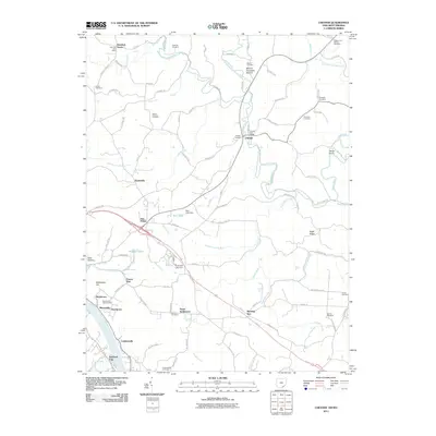
2011 Map of Chester
USGS Topo · Published 2011About this map
Chester serves as a central hub in this corner of Meigs County, situated where the Shade River and Middle Branch Shade River converge. The landscape is defined by its deep burial and memorial history, featuring numerous family and community sites such as Mound Cemetery, Mount Herman Cemetery, and the Kennedy Cemetery. Settlement patterns are concentrated along the river valleys and ridge roads, with smaller locales like Dutchtown and Minersville positioned near the banks of the Ohio River.
Find a feature on this map
105 named features on this map. Tap any name to fly to it.
Don’t see what you’re looking for? This feature index may not catch every label — zoom into the map to look around manually.
Map Details
Editions of this 2011 Chester Map
This is the sole edition of this map. No revisions or reprints were ever made.
Other maps of this area

1907 · Pomeroy
USGS Topo · 1:62,500

1907 · Keno
USGS Topo · 1:62,500

1908 · Ravenswood
USGS Topo · 1:62,500

1908 · Point Pleasant
USGS Topo · 1:62,500

1926 · Ravenswood
USGS Topo · 1:62,500

1926 · Point Pleasant
USGS Topo · 1:62,500

1928 · Ravenswood
USGS Topo · 1:62,500

1929 · Point Pleasant
USGS Topo · 1:62,500

1947 · Columbus
USGS Topo · 1:250,000

1949 · Clarksburg
USGS Topo · 1:250,000