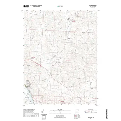
2019 Map of Chester
USGS Topo · Published 2019About this map
Chester lies at the heart of this Meigs County landscape, where the Middle Branch Shade River winds through a network of ridges and hollows such as Dark Hollow and Eagle Ridge. Near the river, Mound Cemetery serves as a significant local landmark, while the southern border is defined by the sweeping curve of the Ohio River. The riverfront is marked by several small settlements including Syracuse, Minersville, and Welshtown, many of which sit below the prominent Minersville Hill. The landscape's industrial and agricultural character is evident in features like the Block Plant and the numerous family-named cemeteries such as Pine Grove Cem and Mount Herman Cem. This survey illustrates the ongoing relationship between the rugged terrain of the Appalachian Plateau and the vital transportation corridor of the Ohio River valley.
Find a feature on this map
157 named features on this map. Tap any name to fly to it.
Don’t see what you’re looking for? This feature index may not catch every label — zoom into the map to look around manually.
Map Details
Editions of this 2019 Chester Map
This is the sole edition of this map. No revisions or reprints were ever made.
Other maps of this area

1907 · Pomeroy
USGS Topo · 1:62,500

1907 · Keno
USGS Topo · 1:62,500

1908 · Ravenswood
USGS Topo · 1:62,500

1908 · Point Pleasant
USGS Topo · 1:62,500

1926 · Ravenswood
USGS Topo · 1:62,500

1926 · Point Pleasant
USGS Topo · 1:62,500

1928 · Ravenswood
USGS Topo · 1:62,500

1929 · Point Pleasant
USGS Topo · 1:62,500

1947 · Columbus
USGS Topo · 1:250,000

1949 · Clarksburg
USGS Topo · 1:250,000