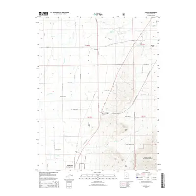
2014 Map of Chester
USGS Topo · Published 2014About this map
San Pitch River and Oak Cr define the hydrological character of the Sanpete Valley, feeding a complex network of agricultural waterworks including Point Ditch and Canal Cr. This 2014 survey reveals an irrigation-dependent landscape centered on the communities of Chester and Spring City. The proximity of the Manti-LaSal National Forest along the eastern edge marks the transition from valley floor to rising terrain, where geographic features like White Hill and Black Hill overlook the agricultural basins. For the genealogist, the map identifies three distinct burial grounds: Chester Cem, Spring City Cem, and the more isolated Pioneer Cem. The presence of McKinley State Reservoir and Olafs Pond underscores the significance of water management in this high-altitude valley, where the settlement pattern follows the road corridors and natural drainage basins.
Find a feature on this map
68 named features on this map. Tap any name to fly to it.
Don’t see what you’re looking for? This feature index may not catch every label — zoom into the map to look around manually.
Map Details
Editions of this 2014 Chester Map
This is the sole edition of this map. No revisions or reprints were ever made.
Other maps of this area

1885 · Manti
USGS Topo · 1:250,000

1895 · Manti
USGS Topo · 1:250,000

1951 · Moroni
USGS Topo · 1:62,500

1956 · Price
USGS Topo · 1:250,000

1960 · Price
USGS Topo · 1:250,000

1962 · Price
USGS Topo · 1:250,000

1965 · Manti
USGS Topo · 1:24,000

1965 · Wales
USGS Topo · 1:24,000

1966 · Spring City
USGS Topo · 1:24,000

1966 · Chester
USGS Topo · 1:24,000