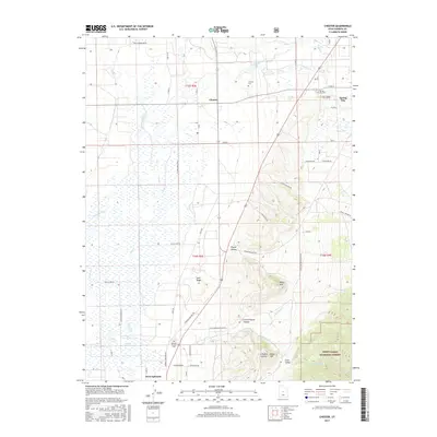
2017 Map of Chester
USGS Topo · Published 2017About this map
The settlement of Chester lies at the intersection of local routes in the heart of Sanpete County, illustrating the agricultural and water-management patterns of the region. The landscape is defined by the San Pitch River and a network of irrigation features such as the McKinley Strates Reservoir and Point Ditch, which support the valley's farms between the high ridges. To the east, the terrain rises sharply into the Manti-Lasal National Forest, where deep cuts like Pigeon Hollow and Limekiln Hollow carve through the foothills. Local genealogy is anchored by several burial sites, including the Chester Cem and the Ephraim Pioneer Cem, the latter situated near the southern edge of the map in West Ephraim. This contemporary survey also shows the transition from the irrigated flats of Sand Ridge to the steep eastern peaks near Spring City.
Find a feature on this map
39 named features on this map. Tap any name to fly to it.
Don’t see what you’re looking for? This feature index may not catch every label — zoom into the map to look around manually.
Map Details
Editions of this 2017 Chester Map
This is the sole edition of this map. No revisions or reprints were ever made.
Other maps of this area

1885 · Manti
USGS Topo · 1:250,000

1895 · Manti
USGS Topo · 1:250,000

1951 · Moroni
USGS Topo · 1:62,500

1956 · Price
USGS Topo · 1:250,000

1960 · Price
USGS Topo · 1:250,000

1962 · Price
USGS Topo · 1:250,000

1965 · Manti
USGS Topo · 1:24,000

1965 · Wales
USGS Topo · 1:24,000

1966 · Spring City
USGS Topo · 1:24,000

1966 · Chester
USGS Topo · 1:24,000