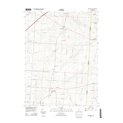
2013 Map of Chesterville
USGS Topo · Published 2013About this map
The village of Chesterville sits at the heart of this survey, where the S Br Kokosing River meets the local roadway network. This rural landscape in Morrow County is defined by its small agricultural settlements and numerous local burial grounds, including the Maple Grove Cem and Salem Methodist Episcopal Cem on the eastern edge. To the south, the village of Sparta anchors a region drained by Mile Run and Light Cr, while the terrain rises toward Hulse Hill. The map also reveals the industrial footprint of the area, notably the Anthony Mining Company Pond near the center. These features, along with smaller hamlets like Lucerne, reflect a typical Ohio township structure where local life centered on the church, the cemetery, and the small-scale management of water resources like Rogers Lake and Lake Peniel.
Find a feature on this map
102 named features on this map. Tap any name to fly to it.
Don’t see what you’re looking for? This feature index may not catch every label — zoom into the map to look around manually.
Map Details
Editions of this 2013 Chesterville Map
This is the sole edition of this map. No revisions or reprints were ever made.
Other maps of this area

1913 · Mount Gilead
USGS Topo · 1:62,500

1915 · Shauck
USGS Topo · 1:62,500

1915 · Marengo
USGS Topo · 1:62,500

1915 · Fredericktown
USGS Topo · 1:62,500

1916 · Mount Gilead
USGS Topo · 1:62,500

1943 · Shauck
USGS Topo · 1:62,500

1943 · Marengo
USGS Topo · 1:62,500

1943 · Mount Gilead
USGS Topo · 1:62,500

1943 · Fredericktown
USGS Topo · 1:62,500

1950 · Marion
USGS Topo · 1:250,000