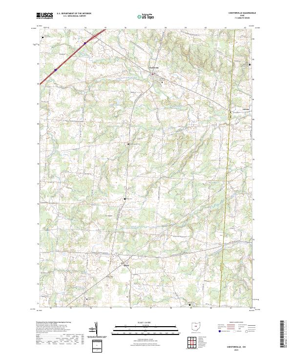
2023 Map of Chesterville
USGS Topo · Published 2023About this map
The Kokosing River and its varied tributaries, including Sylvester Run and the South Branch Kokosing River, define the rural geography of this Morrow County landscape. The village of Chesterville serves as a primary hub, while smaller named points such as Sparta and Lucerne reflect the long-standing agricultural settlement patterns of central Ohio. Genealogists will find a wealth of local-history landmarks preserved here, from the Salem Methodist Episcopal Cem in the northeast to the Maple Grove Cem near the heart of Chesterville. Significant terrain features like Hulse Hill rise above the drainage of Light Creek, illustrating the glacial topography that influenced early road placement. The map also captures several distinct water crossings and bends, such as Cox Ripple and the winding course of Mile Run, providing a precise record of the regional hydrography.
Find a feature on this map
100 named features on this map. Tap any name to fly to it.
Don’t see what you’re looking for? This feature index may not catch every label — zoom into the map to look around manually.
Map Details
Editions of this 2023 Chesterville Map
This is the sole edition of this map. No revisions or reprints were ever made.
Other maps of this area

1913 · Mount Gilead
USGS Topo · 1:62,500

1915 · Shauck
USGS Topo · 1:62,500

1915 · Marengo
USGS Topo · 1:62,500

1915 · Fredericktown
USGS Topo · 1:62,500

1916 · Mount Gilead
USGS Topo · 1:62,500

1943 · Shauck
USGS Topo · 1:62,500

1943 · Marengo
USGS Topo · 1:62,500

1943 · Mount Gilead
USGS Topo · 1:62,500

1943 · Fredericktown
USGS Topo · 1:62,500

1950 · Marion
USGS Topo · 1:250,000