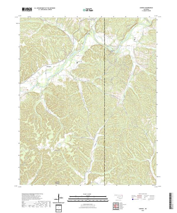
2022 Map of Chewey
USGS Topo · Published 2022About this map
Scraper and the winding course of the Illinois River define this 2022 survey of the terrain where Cherokee and Adair counties meet. The landscape is deeply dissected by a network of drainage systems, including Kirk Springs Hollow, Sawmill Hollow, and Dog Hollow, which create a complex series of ridges and valleys. Small settlements like Pine Bluff are scattered across the uplands, while the bottoms feature landmarks such as Pumpkin Flats. This area is characterized by a significant number of named hollows and bluffs, including the prominent Hogshooter Bluff overlooking the river. For those researching family history or local land use, the map identifies specific burial sites such as Thompson Cem and Chewey Cem. The road network is heavily influenced by the topography, with routes like Chief Keeler Ridge Rd and Dry Water Ridge RD following the natural contours of the high ground between the river and its various branches like Falls Br and Luna Br.
Find a feature on this map
59 named features on this map. Tap any name to fly to it.
Don’t see what you’re looking for? This feature index may not catch every label — zoom into the map to look around manually.
Map Details
Editions of this 2022 Chewey Map
This is the sole edition of this map. No revisions or reprints were ever made.
Other maps of this area

1898 · Tahlequah
USGS Topo · 1:125,000

1899 · Siloam Springs
USGS Topo · 1:125,000

1901 · Tahlequah
USGS Topo · 1:125,000

1903 · Siloam Springs
USGS Topo · 1:125,000

1904 · Siloam Springs
USGS Topo · 1:125,000

1905 · Tahlequah
USGS Topo · 1:125,000

1946 · Fort Smith
USGS Topo · 1:250,000

1954 · Tulsa
USGS Topo · 1:250,000

1958 · Tulsa
USGS Topo · 1:250,000

1963 · Tulsa
USGS Topo · 1:250,000