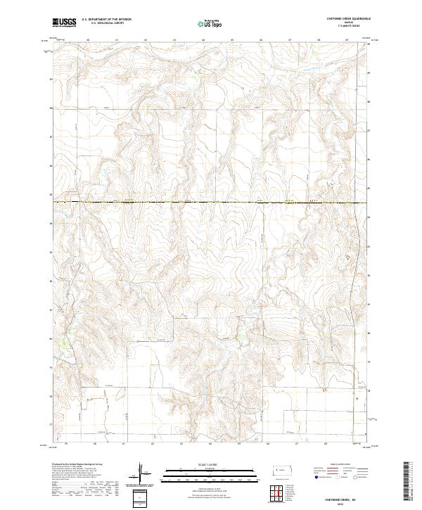
2022 Map of Cheyenne Creek
USGS Topo · Published 2022About this map
The Smoky Hill River meanders across the northern horizon of this High Plains landscape, where the boundary of Gove Co and Lane Co marks a transition in the rural grid. This territory is defined by a dense network of drainage systems, including the branching reaches of Salt Cr, W Salt Cr, and E Salt Cr, which carve subtle relief into the agricultural plateau. The map details the precise section lines and range divisions of t15s r30w and t16s r29w, providing a clear view of the land tenure system in western Kansas. Local transport is anchored by a network of rural routes such as Co Rd 270 and Gage Rd, which follow the cardinal directions of the original surveys. Along the eastern edge, Cheyenne Cr winds southward, illustrating the hydrologic patterns that dictated early ranching and farming settlement in this portion of the state.
Find a feature on this map
17 named features on this map. Tap any name to fly to it.
Don’t see what you’re looking for? This feature index may not catch every label — zoom into the map to look around manually.
Map Details
Editions of this 2022 Cheyenne Creek Map
This is the sole edition of this map. No revisions or reprints were ever made.
Other maps of this area

1955 · Scott City
USGS Topo · 1:250,000

1958 · Scott City
USGS Topo · 1:250,000

1974 · Cheyenne Creek
USGS Topo · 1:24,000

1974 · Gove SW
USGS Topo · 1:24,000
1974 · Orion SE
USGS Topo · 1:24,000

1974 · Healy NW
USGS Topo · 1:24,000

1974 · Shields NW
USGS Topo · 1:24,000

1974 · Manning
USGS Topo · 1:24,000

1974 · Healy
USGS Topo · 1:24,000
1974 · Shields
USGS Topo · 1:24,000