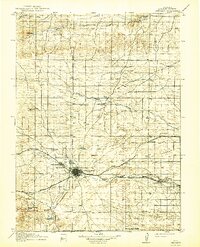
1914 Map of Cheyenne
USGS Topo · Published 1942About this map
Cheyenne sits at the heart of this early 20th-century landscape, serving as a primary hub for four major rail lines including the Union Pacific and the Chicago Burlington and Quincy. The influence of the military is prominent just west of the city at the Fort D.A.Russell Military Reservation, while the surrounding Laramie County terrain is defined by a network of ranching outposts and small rural schoolhouses. Water management is evident through features like Roundtop Reservoir and the winding paths of Crow Creek and Horse Creek. The map documents the sprawling infrastructure of the frontier's transition into a more settled rail-and-ranch economy, noting specific family-held locations such as the Willow Springs Ranch and Pole Creek Ranch along the various creek drainages that supported the high plains livestock industry.
Find a feature on this map
32 named features on this map. Tap any name to fly to it.
Don’t see what you’re looking for? This feature index may not catch every label — zoom into the map to look around manually.
Map Details
Editions of this 1914 Cheyenne Map
3 editions found
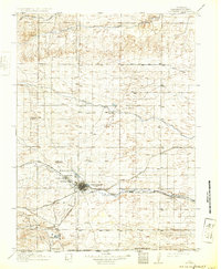
Other maps of this area

1899 · Goshen Hole
USGS Topo · 1:125,000

1905 · Sherman
USGS Topo · 1:125,000

1907 · Livermore
USGS Topo · 1:125,000

1908 · Eaton
USGS Topo · 1:125,000

1909 · Livermore
USGS Topo · 1:125,000

1910 · Eaton
USGS Topo · 1:125,000

1911 · Cheyenne
USGS Topo · 1:125,000

1914 · Cheyenne
USGS Topo · 1:125,000

1950 · Cheyenne
USGS Topo · 1:62,500

1954 · Cheyenne
USGS Topo · 1:250,000