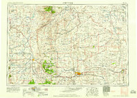
1958 Map of Cheyenne
USGS Topo · Published 1958About this map
Cheyenne sits as a bustling railroad and military hub in the late 1950s, anchored by the sprawling Francis E Warren Air Force Base and the Union Pacific rail lines that cross the high plains. This survey captures the transition from the urban center of the state capital to the high-elevation wilderness of the Medicine Bow National Forest and the Pole Mountain Military Reservation. The landscape is a mix of strategic installations and extensive water management, visible in the numerous reservoirs like Wheatland Reservoir No 2 and Lake Hattie Reservoir.
Find a feature on this map
89 named features on this map. Tap any name to fly to it.
Don’t see what you’re looking for? This feature index may not catch every label — zoom into the map to look around manually.
Map Details
Editions of this 1958 Cheyenne Map
2 editions found

Other maps of this area

1895 · Laramie
USGS Topo · 1:125,000

1896 · Patrick
USGS Topo · 1:125,000

1896 · Hartville
USGS Topo · 1:125,000

1898 · Scotts Bluff
USGS Topo · 1:125,000

1899 · Goshen Hole
USGS Topo · 1:125,000

1899 · Whistle Creek
USGS Topo · 1:125,000

1901 · Hartville
USGS Topo · 1:125,000

1902 · Laramie
USGS Topo · 1:125,000

1905 · Sherman
USGS Topo · 1:125,000

1905 · Laramie
USGS Topo · 1:125,000