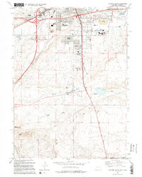
1994 Map of Cheyenne South
USGS Topo · Published 1994About this map
Cheyenne expansion and educational infrastructure dominate the northern portion of this 1994 survey, particularly around the Laramie County Community College campus and the residential pockets of Orchard Valley. The landscape transitions from the dense urban grid of the state capital to the open Wyoming plains, where local schools like Johnson Jr High Sch and Afflerbach Sch serve growing neighborhoods. To the south, the terrain becomes more defined by natural features such as the Terry Anticline and Terry Peak, illustrating the geological character of the high prairie. Transportation and recreation history is visible through the Old Railroad Grade and the Intermountain Speedway. Local drainage patterns are traced by Porter Draw and Crow Creek, while landmarks like the Drive-in Theater capture the commercial character of the era.
Find a feature on this map
26 named features on this map. Tap any name to fly to it.
Don’t see what you’re looking for? This feature index may not catch every label — zoom into the map to look around manually.
Map Details
Editions of this 1994 Cheyenne South Map
2 editions found
Other maps of this area

1908 · Eaton
USGS Topo · 1:125,000

1910 · Eaton
USGS Topo · 1:125,000

1911 · Cheyenne
USGS Topo · 1:125,000

1914 · Cheyenne
USGS Topo · 1:125,000

1950 · Cheyenne
USGS Topo · 1:62,500

1954 · Cheyenne
USGS Topo · 1:250,000

1954 · Greeley
USGS Topo · 1:250,000

1957 · Greeley
USGS Topo · 1:250,000

1958 · Cheyenne
USGS Topo · 1:250,000

1958 · Greeley
USGS Topo · 1:250,000