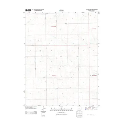
2013 Map of Cheyenne Wells NW
USGS Topo · Published 2013About this map
The Smoky Hill River winds through this section of the High Plains in Cheyenne County, carving a distinct valley across an otherwise uniform landscape of section lines and range roads. This 2013 survey illustrates the enduring rectilinear grid of the American West, where routes like Co Road DD and Co Road CC dictate the movement of people and commerce between the ephemeral drainages of Big Timber Cr and Rock Cr. The topography here is defined by subtle elevation changes that guide water toward the river, which has served as a vital landmark and resource since the earliest days of prairie travel. This map provides a clear view of the modern land management system, showing the township and range boundaries such as t012s r045w that have organized this Colorado landscape for generations.
Find a feature on this map
20 named features on this map. Tap any name to fly to it.
Don’t see what you’re looking for? This feature index may not catch every label — zoom into the map to look around manually.
Map Details
Editions of this 2013 Cheyenne Wells NW Map
This is the sole edition of this map. No revisions or reprints were ever made.
Other maps of this area

1891 · Kit Carson
USGS Topo · 1:125,000

1892 · Cheyenne Wells
USGS Topo · 1:125,000

1893 · Kit Carson
USGS Topo · 1:125,000

1894 · Cheyenne Wells
USGS Topo · 1:125,000

1954 · Limon
USGS Topo · 1:250,000

1954 · Lamar
USGS Topo · 1:250,000

1957 · Limon
USGS Topo · 1:250,000

1958 · Limon
USGS Topo · 1:250,000

1958 · Lamar
USGS Topo · 1:250,000

1969 · Burlington 3 SE
USGS Topo · 1:24,000