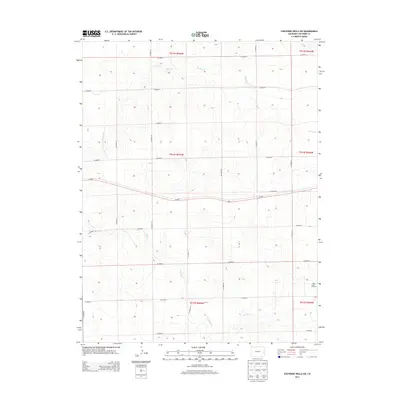
2013 Map of Cheyenne Wells SW
USGS Topo · Published 2013About this map
The high plains of Cheyenne County are defined here by a network of sectional roads and the industrial footprint of the Ladder Creek Oil Field. This landscape, surveyed in 2013, shows a strictly organized grid system where Co Road U and Co Road 6 frame the rural expanse. The few deviations from this geometric pattern occur along the ephemeral paths of Willow Cr in the north and Ladder Cr in the south, which cut subtle drainages across the terrain. Regional transit is anchored by Us 40 E, which bisects the quadrangle from east to west. The map provides a clear record of modern energy extraction and land management, where oil production infrastructure and local county roads like Co Road 36 and Co Road 42 serve as the primary markers of human activity in this sparsely populated portion of eastern Colorado.
Find a feature on this map
27 named features on this map. Tap any name to fly to it.
Don’t see what you’re looking for? This feature index may not catch every label — zoom into the map to look around manually.
Map Details
Editions of this 2013 Cheyenne Wells SW Map
This is the sole edition of this map. No revisions or reprints were ever made.
Other maps of this area

1891 · Kit Carson
USGS Topo · 1:125,000

1892 · Cheyenne Wells
USGS Topo · 1:125,000

1893 · Kit Carson
USGS Topo · 1:125,000

1894 · Cheyenne Wells
USGS Topo · 1:125,000

1954 · Lamar
USGS Topo · 1:250,000

1958 · Lamar
USGS Topo · 1:250,000

1981 · Cheyenne Wells
USGS Topo · 1:100,000
1982 · Cheyenne Wells NW
USGS Topo · 1:24,000

1982 · Cheyenne Wells SW
USGS Topo · 1:24,000

1982 · Kit Carson 4 NE
USGS Topo · 1:24,000