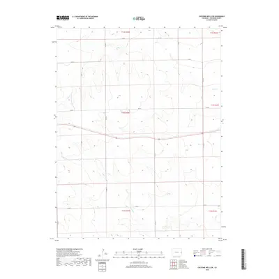
2019 Map of Cheyenne Wells SW
USGS Topo · Published 2019About this map
Willow Cr and Ladder Cr wind through this high plains landscape in Cheyenne County, where the terrain is organized by an orderly grid of the Public Land Survey System. This 2019 survey reflects the rural character of the region, defined by expansive sections like t14s r45w and t15s r45w. The drainage patterns of the ephemeral creeks dictate the subtle contours of the land, providing a stark contrast to the straight-line reliability of the county road network. Transportation is primarily facilitated by a series of maintained routes including Co Rd U and Co Rd T, which navigate the vast open spaces between seasonal watercourses. For those studying the geographic development of eastern Colorado, these markers reveal how the modern infrastructure adheres to the original township and range divisions established over a century ago.
Find a feature on this map
18 named features on this map. Tap any name to fly to it.
Don’t see what you’re looking for? This feature index may not catch every label — zoom into the map to look around manually.
Map Details
Editions of this 2019 Cheyenne Wells SW Map
This is the sole edition of this map. No revisions or reprints were ever made.
Other maps of this area

1891 · Kit Carson
USGS Topo · 1:125,000

1892 · Cheyenne Wells
USGS Topo · 1:125,000

1893 · Kit Carson
USGS Topo · 1:125,000

1894 · Cheyenne Wells
USGS Topo · 1:125,000

1954 · Lamar
USGS Topo · 1:250,000

1958 · Lamar
USGS Topo · 1:250,000

1981 · Cheyenne Wells
USGS Topo · 1:100,000
1982 · Cheyenne Wells NW
USGS Topo · 1:24,000

1982 · Cheyenne Wells SW
USGS Topo · 1:24,000

1982 · Kit Carson 4 NE
USGS Topo · 1:24,000