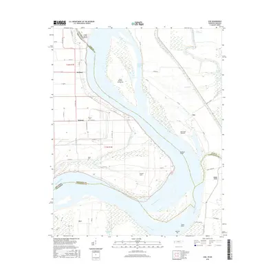
2016 Map of Chic
USGS Topo · Published 2016About this map
The Mississippi River and its intricate secondary waterways define this riverfront landscape at the borders of Tennessee and Arkansas. The map illustrates a shifting environment where the river's path is marked by substantial islands and engineering interventions like the Needham Cutoff. Settlements such as Huffman, Hickman, and Chic occupy the higher ground near the riverbanks, connected by a network of local roads and levees. South of Wrights Point, the Obion River converges with the Mississippi at Tamm Bend, creating a complex delta of sloughs and pockets.
Find a feature on this map
50 named features on this map. Tap any name to fly to it.
Don’t see what you’re looking for? This feature index may not catch every label — zoom into the map to look around manually.
Map Details
Editions of this 2016 Chic Map
This is the sole edition of this map. No revisions or reprints were ever made.
Other maps of this area

1939 · Hales Point
USGS Topo · 1:62,500

1939 · Caruthersville
USGS Topo · 1:62,500

1939 · Blytheville
USGS Topo · 1:62,500

1940 · Hayti
USGS Topo · 1:62,500

1951 · Caruthersville
USGS Topo · 1:62,500

1952 · Hales Point
USGS Topo · 1:62,500

1955 · Hayti
USGS Topo · 1:62,500

1955 · Blytheville
USGS Topo · 1:62,500

1956 · Dyersburg
USGS Topo · 1:250,000

1956 · Blytheville
USGS Topo · 1:250,000