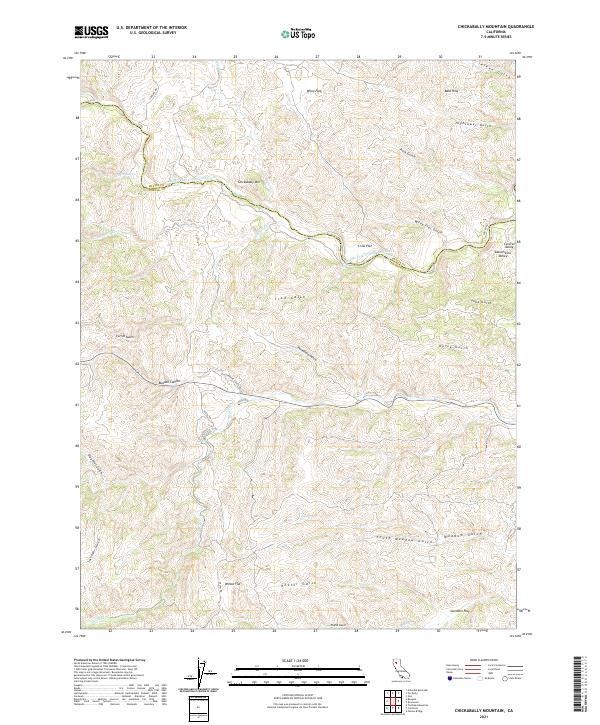
2021 Map of Chickabally Mountain
USGS Topo · Published 2021About this map
Chickabally Mtn dominates this Northern California landscape where the Middle Fork Cottonwood Creek carves a winding path along the boundary between Shasta and Tehama counties. The terrain is defined by a series of named flats and deep canyons, including Wiley Flat, Wilson Flat, and Budden Canyon. These level benches often served as the primary sites for local ranching operations in this transitional area between the Sacramento Valley and the uplifted foothills. A network of rural arteries like Fiddlers Rd, Stewart Ranch Rd, and Vestal Rd provides access through the various gulches, such as Hightower Gulch and Rush Gulch. The complex drainage system, featuring Big Salt Cr and Dry Creek, reveals the erosional history of this region where the high ground of the Bald Hills slopes toward the Central Valley.
Find a feature on this map
42 named features on this map. Tap any name to fly to it.
Don’t see what you’re looking for? This feature index may not catch every label — zoom into the map to look around manually.
Map Details
Editions of this 2021 Chickabally Mountain Map
This is the sole edition of this map. No revisions or reprints were ever made.
Other maps of this area

1890 · Red Bluff
USGS Topo · 1:250,000

1894 · Red Bluff
USGS Topo · 1:250,000

1949 · Colyear Springs
USGS Topo · 1:62,500

1951 · Chanchelulla Peak
USGS Topo · 1:62,500

1952 · Ono
USGS Topo · 1:62,500

1954 · Yolla Bolly
USGS Topo · 1:62,500

1957 · Colyear Springs
USGS Topo · 1:62,500

1958 · Redding
USGS Topo · 1:250,000
1967 · Cold Fork
USGS Topo · 1:24,000
1967 · Oxbow Bridge
USGS Topo · 1:24,000