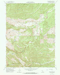
1967 Map of Oxbow Bridge
USGS Topo · Published 1968About this map
South Fork Cottonwood Creek meanders through this portion of Tehama County, defining a landscape of complex gulches and high mesas. The 1967 survey reveals a network of unpaved access routes such as Vestal Road and Pettyjohn Road, which connect isolated topographical landmarks like Table Mtn and Boulder Point. Named flats, including Scofield Flat and Manzanita Flat, suggest areas of relatively level ground amidst the steep drainage systems of Red Bank Gulch and Wildhide Gulch.
Find a feature on this map
44 named features on this map. Tap any name to fly to it.
Don’t see what you’re looking for? This feature index may not catch every label — zoom into the map to look around manually.
Map Details
Editions of this 1967 Oxbow Bridge Map
2 editions found
Other maps of this area

1890 · Red Bluff
USGS Topo · 1:250,000

1894 · Red Bluff
USGS Topo · 1:250,000

1947 · Anderson
USGS Topo · 1:62,500

1948 · Anderson
USGS Topo · 1:62,500

1949 · Colyear Springs
USGS Topo · 1:62,500

1952 · Blossom
USGS Topo · 1:24,000

1952 · Red Bank
USGS Topo · 1:24,000

1952 · Ono
USGS Topo · 1:62,500

1952 · Red Bank
USGS Topo · 1:62,500

1957 · Colyear Springs
USGS Topo · 1:62,500